- The ice cave forms inside Mýrdalsjökull, a 520 km² glacier covering the Katla volcano north of Vík
- Super jeep transport is required to reach the glacier and cave entrance
- The volcano last erupted in 1918 and typically erupts every 40-80 years
- The caldera measures 10 km in diameter and is covered with 200-700 m of ice
Location and Geography
The Katla ice cave sits within Mýrdalsjökull, an ice cap covering the Katla volcano in southern Iceland. The glacier spans 520 km² and sits north of the town of Vík í Mýrdal. The volcano beneath reaches 1,512 metres at its peak.
Mýrdalsjökull lies east of the smaller Eyjafjallajökull glacier, with the Fimmvörðuháls pass between them. The caldera beneath the ice measures 10 km in diameter. Ice cover varies from 200 to 700 metres thick across different parts of the caldera.
The base of Katla mountain spans 30-35 km in diameter. The caldera itself sits 650-750 m deep. It is surrounded by a rim of mountains reaching heights between 1,300 and 1,380 m. Twenty ice cauldrons had been mapped within the caldera by 2019.
Katla Ice Cave Tours
More on GetYourGuide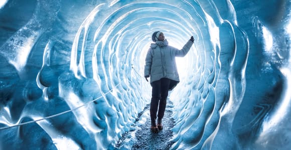 Top ratedBestsellerDay trip · 3 - 12 hoursFrom Vik: Katla Ice Cave and Super Jeep Tour★ 4.6 2 640 reviews✓ Free cancellation✓ Pickup availableBooked 10 times yesterdayfrom €168 per personSee availability →
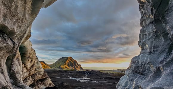 Day trip · 3 hoursFrom Vik: Katla Ice Cave Small-Group Tour★ 4.4 1 417 reviews✓ Free cancellationBooked 7 times yesterdayfrom €158 per personSee availability →
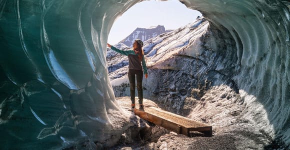 Guided tour · 3 hoursFrom Vik: Katla Ice Cave & Super Jeep Tour★ 4.7 1 523 reviews✓ Free cancellationAvailable today and tomorrowfrom €239 per personSee availability →
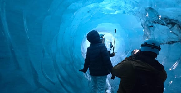 Guided tour · 3 hoursFrom Vík: 3-Hour Katla FastTrack Ice Cave Tour★ 4.9 29 reviews✓ Free cancellationAvailable tomorrowfrom €225 per personSee availability →
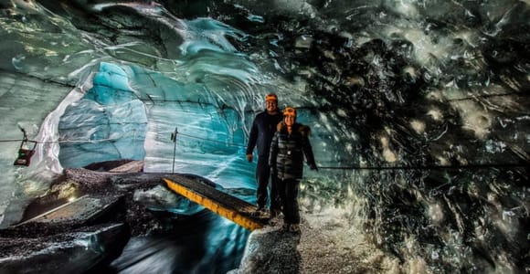 Guided tour · 3 hoursFrom Vik: Myrdalsjokull glacier and Katla Ice Cave Tour★ 4.6 252 reviews✓ Free cancellationAvailable tomorrowfrom €244 per personSee availability →
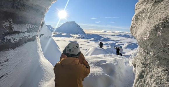 Day trip · 10 hoursReykjavik: South Coast and Katla Ice Cave Small Group Tour★ 4.7 800 reviews✓ Free cancellation✓ Pickup available✓ Skip the lineBooked 4 times yesterdayfrom €239 per personSee availability →
Getting There From Vík or Reykjavík
Tours typically depart from Vík or include pickup from Reykjavík. The glacier sits directly north of Vík, making the town the closest departure point. Super jeep transport is required for the final approach to the cave entrance.
You cannot reach the ice cave independently in a standard vehicle. Check road.is before travel, as volcanic activity and weather can affect access.
The area receives more than 10 metres of rainfall equivalent annually in some sections. Check tour details on GetYourGuide for departure options and schedules.
- Shorter drive from Vík than Reykjavík (glacier sits to the north of town)
- Part of a glacier covering an active volcano with a dramatic landscape
- Can combine with other <a href='/south-coast-tours/'>south coast attractions</a> on the same day
- Accessible location on Iceland's main Ring Road corridor
- Requires super jeep transfer, no independent access on standard vehicles
- Volcanic activity monitoring may affect tour availability without notice
- Weather conditions can change rapidly on the glacier
- Tour schedules depend on glacier conditions and safety assessments
Comparing Ice Cave Experiences
The Katla ice cave forms within the glacier structure. Natural ice caves form and collapse with seasonal changes. Both types sit within glacier environments and require guided access.
Check tour availability on GetYourGuide based on your travel dates. Vatnajökull ice caves and other ice cave locations offer different experiences across the country.
The Volcano Beneath
Katla is an active subglacial volcano that has erupted regularly throughout recorded history. The last major eruption occurred in 1918. The volcano typically erupts every 40-80 years, making it one of Iceland's most closely watched geological features.
The volcano remains intensively monitored by Icelandic authorities. Volcanic activity beneath the ice can create ice cauldrons and affect glacier structure. The 140 km³ volume of ice sitting above the caldera shapes how eruptions might behave.
Check safetravel.is before your visit for current volcanic monitoring updates. Tours operate based on ongoing safety assessments. The combination of active volcanism and glacier coverage creates the unique environment that forms the ice cave.
Compare prices, reviews and free-cancellation options before you book.
Check availability →What to Expect During the Visit
The experience begins with super jeep transport across rough terrain to reach the glacier. The drive itself covers volcanic landscapes and approaches the ice cap. Dress in warm, waterproof layers regardless of season.
The environment stays cold due to the ice cover. Bring waterproof boots and warm gloves for comfort. Guides provide safety equipment and information about the glacier formation.
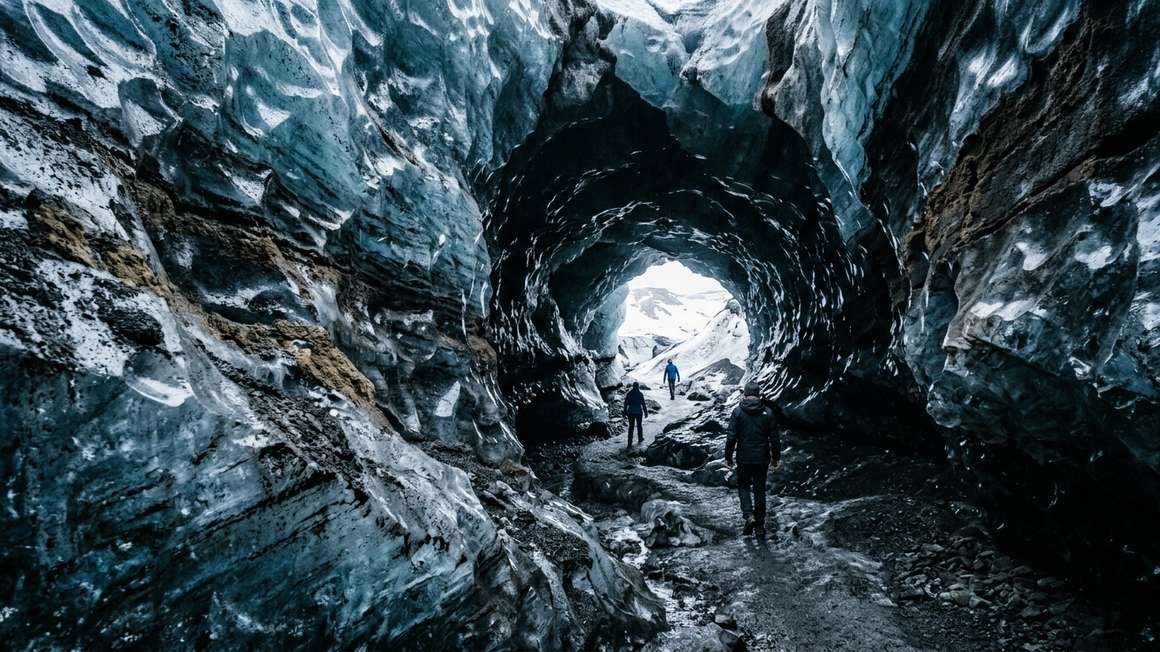
The cave interior shows ice formations, ash layers, and the interaction between volcanic activity and glacier ice. Photography conditions vary with natural light and cave accessibility.
Plan for changing weather, as conditions on the glacier differ from coastal areas. Mýrdalsjökull's high precipitation means rain gear is essential. The super jeep ride back completes the tour, often taking a different route to show more of the landscape.
Combining With Other South Coast Attractions
The Katla ice cave location works well with other southern Iceland sites. Reynisfjara black sand beach sits nearby along the coast. Skógafoss and Seljalandsfoss waterfalls lie along the same route from Reykjavík.
Multi-stop itineraries often pair the ice cave with south coast landmarks. The Diamond Beach and Jökulsárlón glacier lagoon sit further east for longer day trips. Glacier hiking on nearby Sólheimajökull offers another ice experience.
Check safetravel.is for current conditions at Reynisfjara and other coastal locations before planning your route. Check tour details on GetYourGuide for multi-stop options and departure times.
Compare prices, reviews and free-cancellation options before you book.
Check availability →Practical Considerations
Check tour details on GetYourGuide for what safety equipment is included. Wear sturdy footwear and dress in layers you can adjust. Conditions change quickly on the glacier, so pack extra warm and waterproof clothing.
The volcano monitoring system provides ongoing safety data. Tours may adjust schedules based on volcanic activity assessments. Weather windows matter for tour operations.
Camera equipment needs protection from moisture and cold. Bring extra batteries, as cold temperatures drain them faster. The light inside the cave changes throughout the day and with weather conditions outside.
Check before you go for current access conditions. The combination of active volcanism, glacier environment, and weather systems means flexibility helps when planning your visit.
The Katla ice cave offers glacier access beneath a 520 km² ice cap covering an active volcano. The main trade-off is between super jeep-dependent access and location near Vík.
Frequently asked questions
Can you visit Katla ice cave on your own?
No, you cannot reach the ice cave independently. Super jeep transport is required to cross the terrain and access the glacier safely.
Where is Katla ice cave located?
The cave sits within Mýrdalsjökull glacier, which covers the Katla volcano north of Vík in southern Iceland. The glacier lies east of Eyjafjallajökull and spans 520 km².
Is Katla ice cave available in summer?
Check tour availability on GetYourGuide for current schedules and seasonal operations.
How does Katla ice cave compare to Vatnajökull ice caves?
Katla sits beneath Mýrdalsjökull glacier near Vík. Vatnajökull ice caves sit further east in Iceland. Check tour details on GetYourGuide for each location.
When did Katla volcano last erupt?
The last major eruption occurred in 1918. The volcano typically erupts every 40-80 years and remains intensively monitored.